Traduit par Ghislaine Jauselon et Don Church
Spectacular scenery
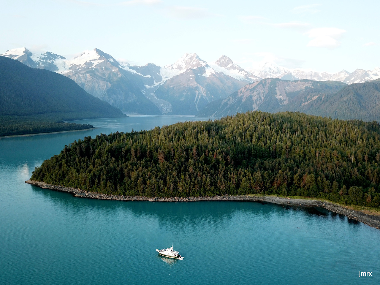
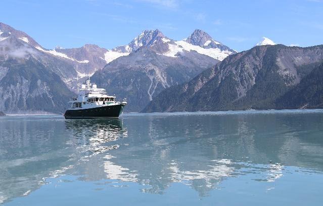
In the coolness of the summer, in the south east of the gulf of Alaska, in July 2019, her back to the pacific ocean, Jade, magnificient trawler, makes her way into a narrow passage, opening into a vast bay with a grandiose vistas: Lituya Bay.
To the left, entering through the passage, an accumulation of massive boulders forms a natural breakwater, a vestige of an old glacier from fifteen thousand years ago.
To the right, a few yards away, sunning on huge black insular rocks, sea lions watch us intrigued by our presence.
This rock is the end point of the passage, port side at the entrance
233 years ago, exactly, at this very same spot, the La Perouse expedition encountered its first tragedy.
La passe de Lituya Bay vue d’avion. (photo Yves Bourgeois)
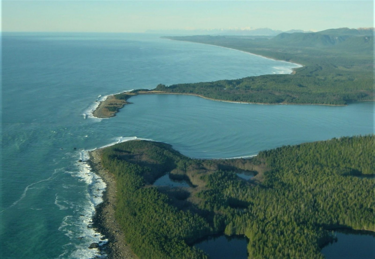
After going through the passage, we discover on our right, a bay, deep into the rocky coast and covered by dense fir trees forest, from where come out once in a while big brown bears looking for food. We decide to anchor in this bay.
The spirit of Mr. La Perouse and his crew will remain with us for the duration of our stay in this place.
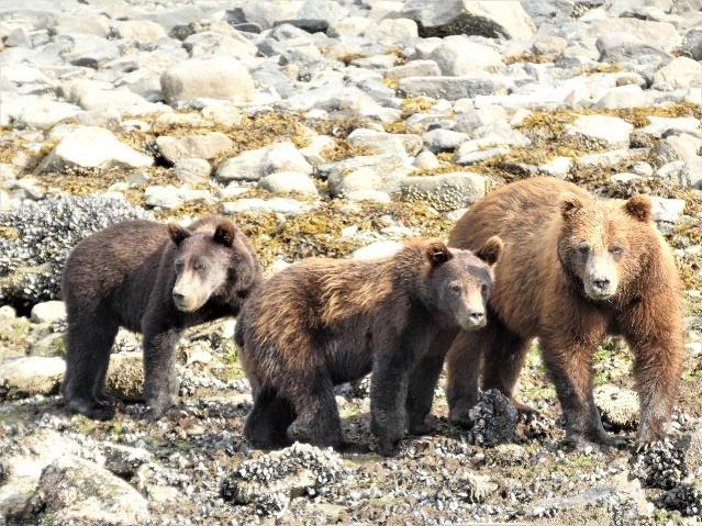
Often seen in Lituya Bay : Griszzly bears
2018
In fact, Jade had already been in Lituya Bay before. Infatuated by the charm of this bay, Joël, the owner, has returned four times to this bay. Joël, an active follower of the Association Salomon, of which, the president, the vice president and the secretary are also part of his crew onboard.
In July 2018, we all had an ardent desire to impregnate ourselves with the magic of this place. Full of emotions, and naively thinking that nothing much had changed in the last two centuries, we disembarked on the island, deeply absorbed by the desire to find traces of the navigator.
La Perouse in history
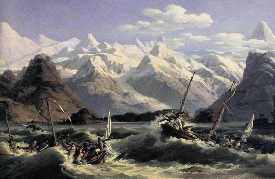
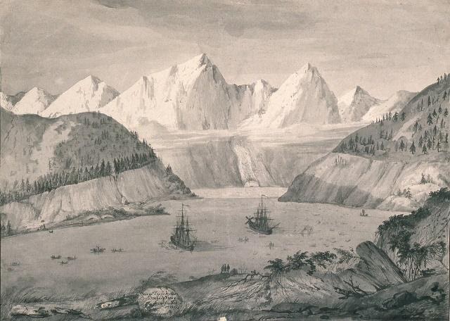
On July 3 rd. 1786, early in the morning, with a favorable wind and a rising tide, both frigates from the La Perouse expedition sail through the passage and anchor at the mouth of the bay. The sea bottom reveals itself not to be adequate.
Very soon, with strong currents created by the tide and a strong gust of wind from west north west, that pushes landward, both vessels are in trouble, too close to shore, La Boussole slips slighly, but luckily without damage.
As written in his log book, La Perouse will say : "in my last thirty year of navigation, I have never seen two vessels so close to perdition".
Then the wind dies back and the currents turn favorably.
Both vessels, with the assistance of their secondary embarcations, change anchorage and settle under the proctection of the only island in the bay, island that La Perouse will name a few days later : Île du Cenotaphe.
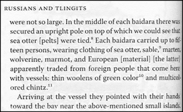
In no time life onboard gets organised with the inhabitants of the bay. Numerous canoes, handled by Tlingit Indiens come along the shore. Salmon, prolific fish at this time of year is base for trading.
La Perouse obserbed as well an abundance of sea otters while sailing along the Alaskan coastline. He bought several skins of this animal for its fur. They found a variety of goods to trade, and the scientists from the expedition enriched their collection.
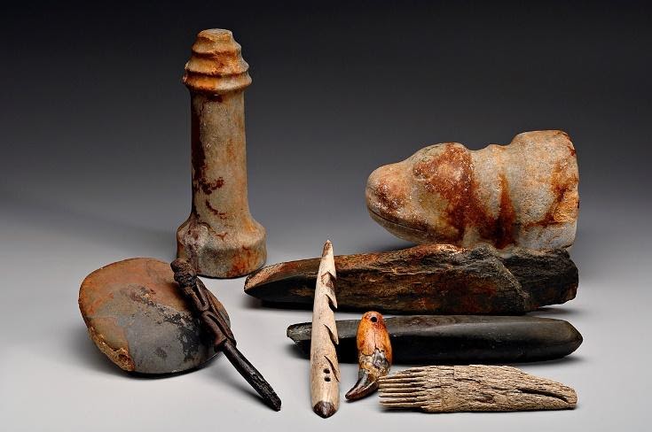
These objects were found on the L’Astrolabe and the Boussole shipwrecks, in Vanikoro (Salomon Islands)
and are exclusivly from Lituya bay. Disturbing destiny (Drassm/ Photo Frédéric Osada)
The imaginary
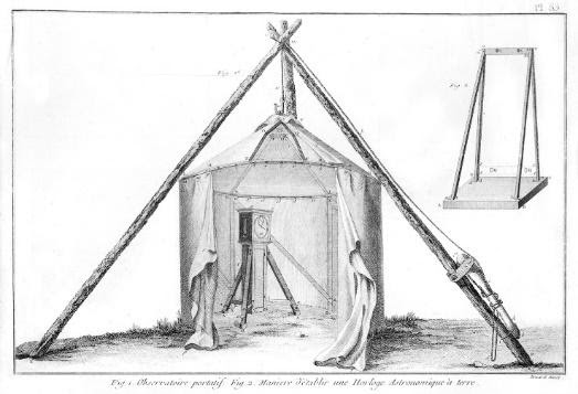
As previuosly done in 2003 by a small team lead by Alain Conan *1, president and founder of the Salomon Association, escorted by rangers, we set foot on the Cenotaphe island. As we first step on the island, we imagine, with a strange reality, officiers in colorful uniforms and wearing tricorn hats, standing guard over astronomes Lepaute Dagelet and De Monneron, absorbed in their calculations under the protection of the observatory tent erected in the north of the island. This observatory allows them to follow the stars necessary to calculate time.
Exemple of observatory installed on the Île du Cenotaphe by the astronomes of the expedition.
Further along, priest Monges, man of the cloth but also a mineralogist, tries to extract numerous fossils and garnets incrusted in the big boulders along the shore line.
Seated on a promontory, Duche de Vancy, landscape artist of the expedition, applies himself to the drawing of both frigates at anchor and the native canoes surrounding them, without omitting the huge blocs of ice floating about, establishing the feeling of the moment with a swift pencil stroke.
Close by, chopping wood sounds echoe from the forest of firs, where the sailors are making fire wood supplies, as well as setting the best trees aside to carve spare parts for riggings.
Still under the spell of the history of the place, the vision of Jade anchored around the point of the island brings us back to reality.
Jade anchored at l’Île du Cenotaphe
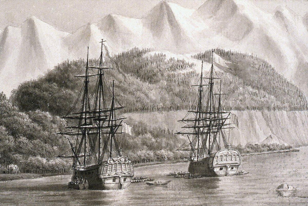
La Boussole and l’Astrolabe anchored in Lituya bay drawing by Blondela 1786.
Life onboard
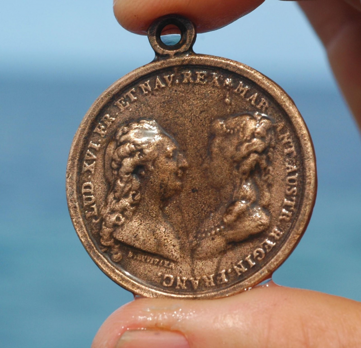
The decks of the frigates is a favorite place for the indegenious people who become bolder with time. Thievings are numerous, but Mr. La Perouse is not too concerned. However, when a fire arm goes missing, the french people decide to settle only on the island, which they purchace from what seems to be the chief, with no illusion that the transaction is realy valid. A bottle containing the act of purchage and a a medallion of Louis XVI are buried at the north end of the island "at the foot of a big bolder".
Médaille à l’effigie de Louis XVI et de Marie Antoinette distribuée par La Pérouse à chaque escale.
Celle-ci a été trouvée sur l’épave de La Boussole à Vanikoro (Ass. Salomon/photo Pierrot Larue)
Scientists, each focussed on their own specialty, explore the bay. De Monneron and Bernizet take geographical surveys of the place. The high snowy mountain tops and the glaciers majesticallty dominating the bay, are named after seamen and scientists from the expedition as well as from important figures of the Versailles court: Monts Crillon, La Perouse, De Langle, Dagelet. Recents maps still show these names.
To have a better geographical understanding of the place, Mr. La Perouse sends a party to explore the end of the bay and also to climb one of the three glaciers that end there, in order to reach the summit. From the dominant point of view, they then could determine if the fluvial valley coming from the interior would give access to the great lake region. The party will quickly abandon this impossible mission.
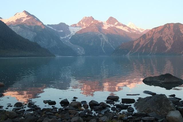
View of the end of the bay, from the shore of l’Île du Cenotaphe, where glaciers terminate.
During their stay, Mr. La Perouse will name the bay " Port des Français."
The hydrography of the place is a priority for Mr. La Perouse, who, following Louis XVI instructions, can see in this magnificient protected bay, an important commercial future for France, especially for otter skins, an abundant animal in this coastal region.
The tragedy
On july 13 1786, he gives written instructions to the officiers assigned to complete the hydrography of the passage, notifying their superior M.d Escures, that the tidal bore is particularly dangerous. Work must be done only during slack tide. Early in the morning, three small boats leave in the direction of the passage, situated more than three nautical miles aways. In the late morning, only one will come back, under Mr. Boutin command, carrying the terrible news.
Twenty one sailors, officers and deck hands drowned when their boats sunk, caught in a violent tide bore.
There was no survivors and no bodies nor any pieces of the embarcations to be found despite active search from the Boussole and l’Astrolabe.*2
Painting by Louis-Phillipe Crepin, representing the two small boats in Lituya Bay passage
At the end of July 1786, on the west side of the island, a Cenotaphe was erected in memory of the twenty one sailors who perished, and a bottle containing the list of their names was burried on the site.
Monsieur DE Lamanon, the expedition physicien, wrotte :"at the entrance of the port perished twenty one brave sailors, whomever you are, join your tears to ours"
The island is then called after the monument erected to the memory of theses men, l’Île du Cenotaphe.
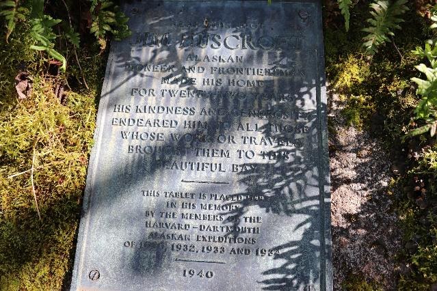
Jim Huscroft
September 2018, we find no traces, no mounds of rocks that could have been relics of the Cenotaphe, which had been made of durable material construction. In our search, we are surprised to dicover a bronze tablet, firmly screwed onto the biggest rock, in the western part of the island. It says: "near this spot Jim Huscroft, alaskan pioneer and frontierman made his home for twenty two years. His kindness and generosity endeared him to all those whose work or travels brought them to this beautiful bay. This tablet is placed here in his memory. "
Quite perplexed, we realise how ignorant we are of the past of this place since the La Perouse expedition. The island du Cenotaphe has been inhabitated for 22 years!
Lituya Bay, despite its appearances, was not just a summer gathering place for the Tlingits to come salmon fishing.
Plaque en bronze découverte à l’ouest de l’île du Cénotaphe.
A new trail is opening in front of us: Jim Huscroft. This man must not have been an ordinary one, to have his name carved in bronze. Internet would later help us retrace his path and his story in a remarkable book "Land of Ocean Mist" by Francis E Caldwell.
A year later, in July 2019, after reading this book, our approach to the site has changed. Entering Lituya Bay, our vision of this magnificient bay is not the same any more.
Life in the bay since Mr. La Perouse visit
At the begining of the twentieth century, three hundred people lived in this rudimental environment, often in search of gold.
Russia having sold Alaska to the USA in 1867, adventurers, trappers, gold diggers, mountain climbers, volcanologists, fishermen and other travellers,all have explored the region.
A Ford T pickup truck was even brought there in 1933. It was to go on a primitive road along the coast line between the south-est of the bay to the La Perouse glacier situated fifteen miles south.
it was used to carry in its bin reddish sand from the shore, color due to the garnet powder contained in it, and supposidly with presence of gold flakes. The chassis of the truck could not bear the load for long. Taken apart, its engine and some parts of the transmition will then be used for a water pump, tool very useful for the search of the precious metal.
It is in 1917 that Jim Huscroft arrived for the first time in Lituya Bay. After living in an indian village located at the entrance of the bay, he built himself a first cabin around 1920, north of the Cenotaphe island, then later on an other one in the west, becoming the first european resident in the region.

Île du Cenotaphe view from the west of the bay.
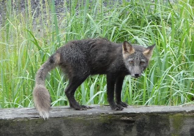
He built a cabin facing the entrance of the bay and a vegetable garden from which he shared its produce with adventurers. His hospitality and his personality are soon appreciated. His good reputation allowsed him to expand his cabin and it becomes a must stop for visitors of Lituya Bay. The place got the nickname of "Huscroft Hotel".The master of the place falls under the spell of a silver coyotte name : Tuffy.
Silver coyotte, frequently seen in Alaska. (photo by Véronique Proner)
he gold rush does not seem to be very lucrative, so he starts a coyotte farm of which the skin is well sought after in the 1930.
The presence of the La Perouse expedition and its activities in this bay and more particularly on the Cenotaphe island one hundred and fity years earlier, was known to Jim. Despite extensive research, Jim found no traces of the expedition and concluded it was because of the Russians.*3
The Russian Presence
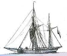
In Juin 1788, while The La Perouse expedition had found its demise on Vanikoro Island, Captain Izmailov, on board the Trois Saints, took possession of the bay in the name of Catherine The Great of Russia. His orders were to spead and affirm the Russian authority in Alaska, and in doing so, to erase any evidence of foreign rivality.
Gaillote similare to Izmailov ship.
The Cenotaphe must probably have been destroyed then, the bottle countaining its message in memory of the twenty one sailors who perished and the the medaillon of Louis XVI, burried under the monument, as well as the other botlle containing the act of sale of the island by Mr. La Perouse, in the name of the king of France, must have been taken then. Perhaps brought back to Russia on board the Trois Saints. What became of these relics ?
Tsunami or Kah Lituya monster
Studying the drawing made by Duche de Vancy in july 1786, one can observe a horizontal line in the high lands, seperating cliff and forest. This detail, noted more than two centuries ago is interresting, showing the geological activity of this area. Indeed, at the end of the bay where five glaciers terminate, is a fault named Fairweather falt, causing frequent earthquakes.
These tremors cause the falling of huges bolders and chunks of ice into the deep waters of the bay, provoking devastating tsunamis.
Drawing by Duche de Vancy 1786. we can see la Boussole and L’Astolabe on the right with its wind-mill,
anchored at the Île du Cenotaphe.Tlinglits canoes and floating chunks of ice are visible.
At the end, glaciers ending in the fiord. Cliffs on both sides must have been cut by tsunamis.
Mr. La Perouse describes in his journal that during one of his explorations of the place, he almost lost his life due to the instability of the area. One of the canoes flipped upside down without anybody been hurt, while taken into a violent turmoil created by the fall of a chunk of a glacier.
A chapter of Francis. E. Cadwell's book mentions the danger of one's prolonged stay in this region due to the risk of tsunamis. We were aware of this fact and approached the subject quite often in our discutions.
It is probably the reason why the Tlinglits named this bay the Kah Lituya monster. They only came to this place in salmon fishing season, previous villages in the bay having repeatetly been destoyed by tsunamis.
On the 27 october 1936, Jim Huscroft witnessed one of them. Hearing the sound of an enormous wave coming from the end of the bay, he barely had time to take refuge on high ground, along with his friend Ernie Rogan. His buildings are greatly damaged and both his vegetable garden and his coyotte farm are swept away. Jim Huscroft is very shaken by the experience and his loss. In 1939, sick and depressed, he accepts with great reluctance to be brought to Juneau by one of his friends. On board his boat, named symbolicly Cenotaphe, Jim passes away at the age of 66.
More recently, on the 8 th. Of July 1958, a strong earthquake of a magnetude of 8.3 provokes the collapsing of a mountain side in the north end of Lituya Bay.
The huge displacement of water following the collapse creates a wave of 524 meters, rising on the mountain side opposite the fiord.
The deforestation is the proof of this worldwide unique devastation event.
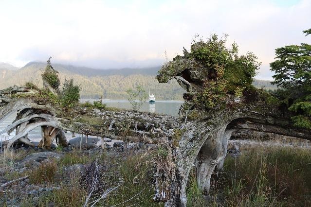
In 2019, we could still see tree trunks littering the seashore all around Lituya Bay, often facing the same direction.
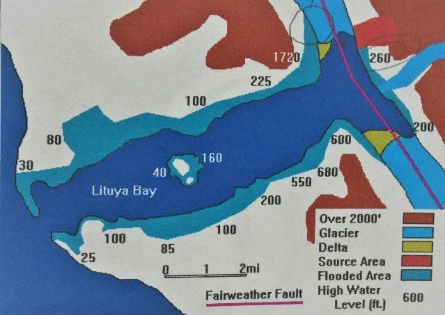
In turquoise blue, areas devastated by the wave, hights are scaled in feet.
View from the north west of the Cenotaphe island. On the forground, fallen trees, probably there since 1958.
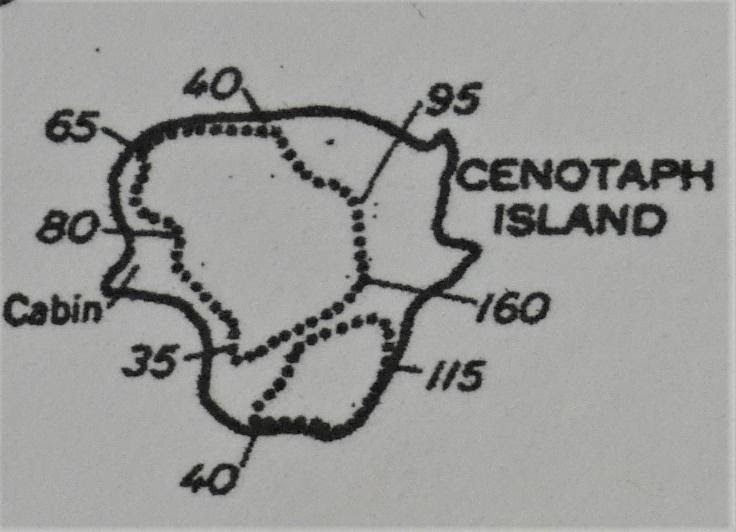
The impact of the gigantic wave created by the tsunami is affecting the entire bay. On the island of the Cenotaphe, water rose up to 48 meters on the east side, and 12 meters on the west side. It carved a channel through the middle, almost severing the island in two. The remains of Jim Hascroft 's settelment must have totally disappeared then.
Heights, in feet, of the different levels of water reached around the Island after the 1958 tsunami.
Jim Huscroft cabin location is noted on the drawing.
In lieu of the probable location of his cabin we found, in 2019, a pile of stones which could have been the basement foundations. The repetition of these tsunamis has transformed the geography and shape of the bay.
The hope to find the bottle and its message, the medallion of Louis XVI, and any other relics dating from the French expedition seems to us, now, very futile.
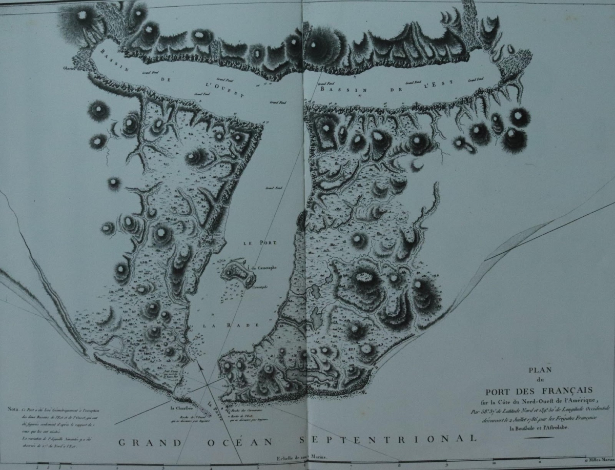
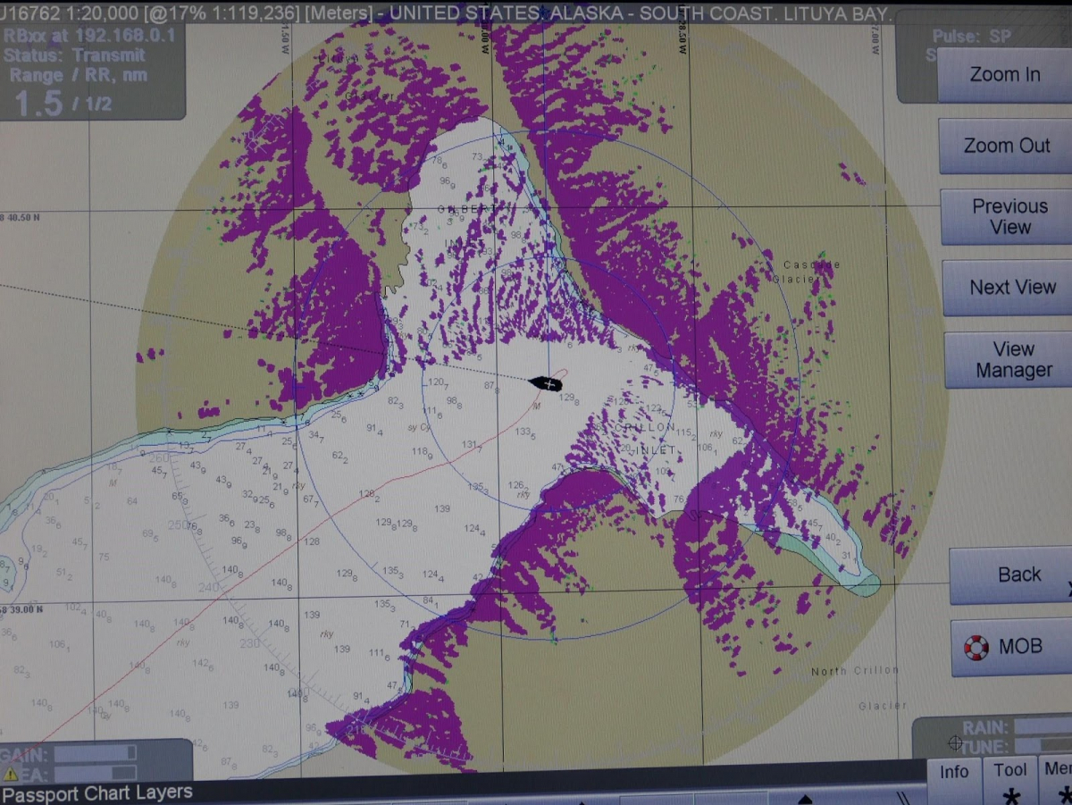
Remarquable carte levée par l’expédition La Pérouse en juillet 1786 (Atlas du voyage de La Pérouse).
The superposition of the image from the radar (in violet, that showing every thing above water,
on top of the chart, show clearly the absolescence of this chart. (photo by Joël Marc).
We make another observation:the sea bottom of the bay, previously described by Mr. La Perouse as deep, and also confirmed by recent hydrographic maps, is now filled with earth and rocks, brought by the succession of collapses from the surounding mountains and glaciers.
It is impossible to rely on recent nautical charts to navigate in these waters.
Can we beleive that the" Kah Lituya monster" will ever wake up again?
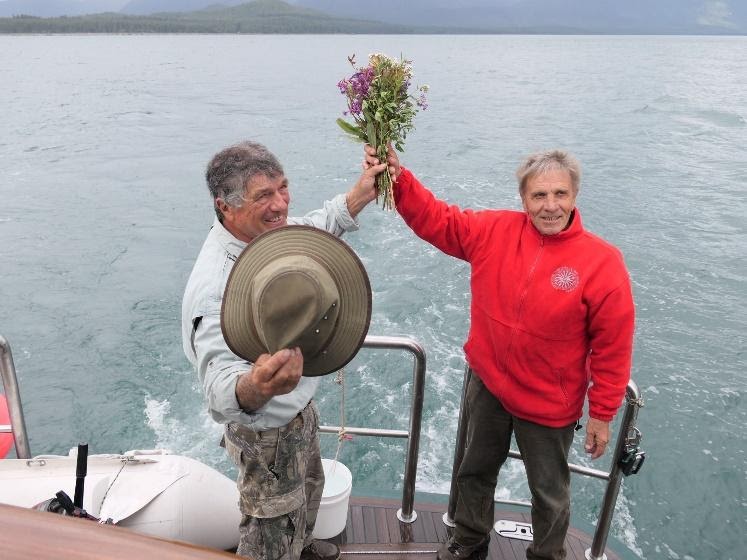
Leaving this magnificent scenery, today devoid of human presence, and sailing through the passage, we symbolicly throw in the wake of Jade, a bouquet of flowers picked on the shore of the island.
Our thoughts and our vision of the bay are different. Its past, knowned better to us, today, gives it a geographical structure upon which our gaze, full of emotion, lays.
Mr. La Perouse wrotte in his journal, about Lituya Bay: "Without any doubt, the most beautiful bay in the world".
A last homage leaving the bay (Photo by Joël Marc).
*1-The Association Salomon, founded in 1981 by Alain Conan and his friends, aims to discover the "Mystere Laperouse". There has been height excavation campaigns and the creation of the Musee Maritime (maritime museum), exhibiting the extraordinary collection of objects found in the shipwrecks.
*2-On the 22 nd. Of July 1786, Tlingits brought items to Mr. La Perouse expedition's vessels, from the sunken embarcations, saying that they found them on shore, south of the entrance of the bay. It may be that the Tlinglits, of whom Mr. La Perouse thought little of:"and every day we have to complain about them...their civilisation, with their thievery and deceit, is as much advanced as this of the coyotes", may have kept more than they brought to the vessels.
The embarcations may have been intact, along with all their armaments and probably a few bodies washed ashore. In 1788, sailing between Yakutat and Lituya Bay, on board the Trois Saint, the Russians Izmailov and Bocharov noted in their journal that several Tlingit sailing on board a big canoe were wearing uniformes "made of fine woollen fabric, green in color with multi color embroideries."
Extrait du journal de bord d’Izmailov en1788
(ouvrage Under mont saint Elias – Frederica de Laguna – Smithonian Institution Wa. USA)
The swivel gun made in Rochefort in 1762, and belonging to an american woman of Tlingit origin, living north of Seattle, is probably from one of of the two small boats.
*3_Commemorations and official recherches of the remnants on the Island of the Cenotaphe were numerous. In july 1979, a group from Juneau, first put a board, which rotted, and in 1985, the same group puts a new plaque, made of bronze, which later on will be dismantled.
Meanwhile, in 1982, a party from the National Park Service found a flat stone of big dimenstions, on the summit of the island beliving to have found the location of the Cenotaphe. After scientific rechearch, it was in fact, just a natural shaped rock.
In 2005, 2006, and 2007, other parties from the National Park Services failed as well in their recherche.